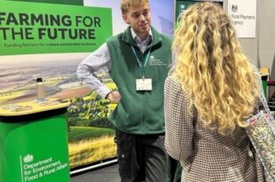
If a water company breaks the rules, for example by polluting rivers or letting out sewage illegally, it can be taken to court and fined.
Last year, the money collected from fines on water companies from April 2022 to October 2023 was invested into the £11 million Water Restoration Fund.
This initiative formed part of ongoing efforts to hold water companies to account and to restore rivers, lakes and seas.
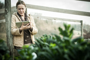
Grants were made available to support local projects.
There were 2 types of grants:
- Development grants ranging from £75,000 to £250,000, designed to build capability
- Delivery grants ranging from £500,000 to £2 million, designed to accelerate or support projects that had already been planned
We’re pleased to say that a total of 51 projects secured funding. Some projects are now supporting groups of farmers to work together across a whole river catchment area so that projects can deliver bigger benefits than individual farms working alone.
Successful delivery projects
- Emm Brook Restoration Project
- Improving the Evenlode Catchment (ItEC)
- Panford and Blackwater Catchment Regeneration Project
- Teign and Taw Fisheries Management
- Upper Witham (Little Ponton) River and Floodplain Restoration Project
Successful development projects
- 20-year strategy for restoration of river & floodplain habitats in the rivers Nene, Ise and Tove
- A collaborative restoration plan for the Cam
- Arlington Lake – fish opening and habitat enhancement
- Ashfoldside Metal Mines Project
- Broadland Catchment Partnership Development Plan
- Catchment Planning – Avon, Gara & Slapton Ley, and Kingsbridge Salcombe Estuary
- Citizen Crane – catchment scale restoration of an urban river
- Coate Water SSSI Restoration Project
- Colne Catchment – Riverbed biofilm communities as indicators
- Connecting Limbs
- Dewsbury Country Park – Water Restoration
- Derwent SSSI Project
- Ealing Regional Park River Restoration Plan
- FERRIS – Foss & Esk River Restoration Improvement Studies
- Feasibility Study for Doe Lea Catchment Water Restoration Environmental Framework
- Great Ouse Blue Connections
- Heddon Valley
- Hornsea Mere Restoration
- Ilford Arrival: Restoring the Lower Roding
- Improving the West Looe River Water Body (Development Project)
- Lakes Biosecurity Priority Area Project
- Otter Catchment – Source to Sea
- Pickhill Beck
- Recovering the Deben – water quality improvement and fish passage feasibility
- Rediscovering the River Colne, Watford – development
- Restoration of the River Mere Catchment
- Restoring the River Ching, Bringing Back the Fish
- River Cocker Catchment Restoration
- River Tame Barriers Modification Feasibility Study
- River Windrush and Sherborne Brook Catchment Improvement Project
- Rye to Good Phase 3
- Slade Brook NFM Project Development
- Solutions for the SUNO, Foss, Wiske, & Wharfe
- Stanwick Lakes Hydrological Survey
- Stalybridge Restoration Planning
- SWEF Water Restoration Project
- The Keston Ponds Project
- The Wandering Wandle
- Upper and Lower Staveley Weirs – fish passage development work
- Upper Barle River Restoration Project
- Washfield Wetland
- Water in the Wharfe
- Water Wise Farming
- Welland Headwaters Nature-based Solutions (NbS)
- Windermere STEP (Septic Tank Engagement Programme)
These projects will bring rivers and landscapes back to life by using nature-based solutions. That could mean re-meandering rivers so they flow more naturally, restoring wetlands and other water-dependent habitats, or removing barriers so that fish can move freely.
Communities benefit when water companies are held to account, with better access to blue and green spaces.
Alongside this, some projects are testing out new technology to help them go further: using tools like data analysis, artificial intelligence, mapping software and remote sensing to guide and measure their work.
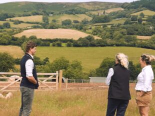
Project spotlight: Swaledale & Wensleydale Environmental Farmers
Emma Orde-Powlett, project officer from the Swaledale & Wensleydale Environmental Farmers project, explains how their project is improving water quality and benefiting farmers across the upper catchments of the Swale and Ure rivers.
Swaledale & Wensleydale Environmental Farmers (SWEF), is a group of farmers and moorland managers working together across the upper catchments of the Swale and Ure rivers, covering 85,000 hectares.
Our goal is simple: to look after nature, tackle climate change, and improve water quality — all while keeping farming sustainable.
Working together means we can achieve more. By collaborating, we can restore and protect peatlands, enhance biodiversity, improve water quality, and manage our land in ways that help us move toward net zero carbon farming by 2040.
At the same time, we’re exploring practical ways to make these actions financially viable and ensure farmers are rewarded for delivering these environmental benefits.
We also care about our communities. Integrating the social and cultural aspects of farming into our projects helps connect people with the land and with each other, while raising awareness about the importance of protecting our natural environment.
It starts with mapping. By creating a baseline of current land and water management, we can see what’s working well and where there might be opportunities to improve.
This approach isn’t just paperwork. It’s a way to make practical, targeted improvements that benefit both the farm and the wider landscape.
We’ve been building on methods used in National Lottery Heritage Fund projects, which let farms work together while keeping things consistent and based on best practice.
Experts including Jennie Stafford from the Game and Wildlife Conservation Trust and Abigail Mace from the Yorkshire Dales Rivers Trust have provided invaluable guidance, helping shape the work and plan the next steps.
The first of 8 individual farm plans is now in place. Stuart Raw, a farmer and ex-drystone waller from Castle Bolton, has worked closely with the project team, bringing an open and adaptive approach to potential plans on his farm.
The next step is to develop these plans into fully costed projects, creating practical templates for future work. Each plan is tailored to the farm’s unique needs, supporting productivity and environmental stewardship while ensuring farmers are fairly rewarded for delivering positive changes across the landscape.
Practical fieldwork is now underway. To improve soil structure, water infiltration, and pasture productivity we’re testing interventions.
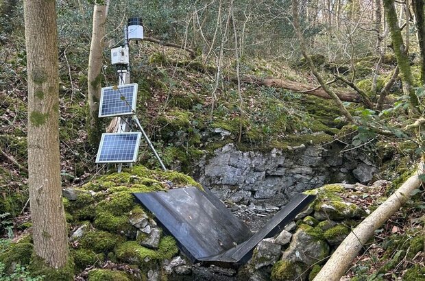
We’ve flown a high-resolution LiDAR survey, which uses light pulses to create detailed 3D maps of the landscape to monitor the surface impact, and after upcoming farmer training, detailed measurements of soil permeability, moisture, and compaction will begin to assess how well the interventions are working.
Training is an important part of the project. A number of sessions with Dr Nick Chappell from Lancaster University will help farmers build the skills to track progress and monitor the hydrological effects of the interventions they make. We want to create a local understanding of soil and water management, helping farmers to see what works and why.
We selected the site for the first new wetland scrape, and this has been installed. A scrape is a shallow depression constructed to fill with water at certain times of the year, forming a temporary pond or pool. Hydrological monitoring equipment has been set up alongside an existing scrape, providing data to optimise future scrape designs. It will also help us to understand how interventions affect water flow and quality.
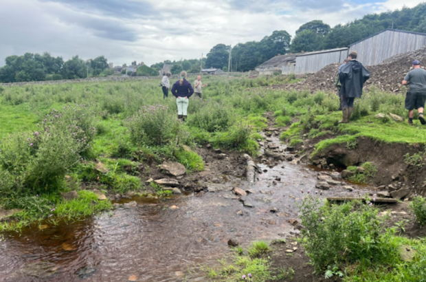
It’ll be possible to measure how well aeration works, by collecting solid data on how water moves through the soil, how wet it is, and how compacted it becomes. Community engagement is another important part of our work. At the Reeth and Wensleydale agricultural shows, farmers and visitors had the chance to explore monitoring equipment and learn more about water management.
Building on this enthusiasm, our plans include 2 water-testing campaign days to measure dissolved organic carbon, nitrate and turbidity (clarity of water) upstream and downstream of different interventions.
Thank you to all the farmers, professionals, and volunteers for their continued support.
Get in touch
If you’re working on a Water Restoration Fund project with farmers and would like to share your story on the Farming blog, leave a comment below and we’ll be in touch.

 The
The 
6 comments
Comment by Louise Wainwright posted on
Sarah,
Hi Sarah,
Hope you got my earlier reply to the above ?
I am also a Devon County Councillor for the Salcombe Division. I am meeting with the DCC Water Quality think tank and the Director of Climate Change, Environment and Transport this Monday.
DCC wants to know when the next Water Restoration Fund applications will open in 2026.
Comment by Sarah Stewart posted on
Hi Louise,
There are no further rounds planned for the WRF — it was a one-off fund. That said, its sister programme, the more established Water Environment Improvement Fund (WEIF), is expected to continue into the next financial year.
Best wishes,
Sarah
Comment by Olivia Nelson posted on
The Floodplain Meadow Partnership with its partners Wildlife Trust BCN, the River Restoration Centre and The Nene Rivers Trust have been successful in securing one of the grants offered through the Water Restoration Fund. Our project is a development grant that will carry out field data collection and analysis to produce a twenty-year strategy for river and floodplain habitats in the Rivers Nene, Ise and Tove in Northamptonshire. It will start in January 2026 and run for 12 months. We would be keen to share the progress of this project - probably in autumn 2026 following the survey work in the summer.
Comment by Sarah Stewart posted on
Hi Olivia,
Congratulations to the partnership on securing funding - this is exactly the sort of thing we would love to highlight on the blog. I've just emailed.
Best wishes,
Sarah
Comment by Louise Wainwright posted on
Catchment Planning – Avon, Gara & Slapton Ley, and Kingsbridge Salcombe Estuary.
The Water Restoration Fund has empowered our grass-roots initiative that has successfully brought together parish councils, farmers & landowners and community groups in our three catchments to develop our BLUEprint for Rivers https://www.blueprint-for-rivers.org/
http://www.avon-river-champions.org
Comment by Sarah Stewart posted on
Hi Louise,
Can we contact you using the email address you shared when you posted the comment? It would be great to feature the work of the team.
Best wishes,
Sarah