https://defrafarming.blog.gov.uk/watch-episode-2-land-management-plans-and-the-sustainable-farming-incentive-pilot/
Watch Episode 2: Land Management Plans and the Sustainable Farming Incentive Pilot
Martin Hole, Montague Farm, East Sussex
My name is Martin Hole and I farm here at Montague Farm on the Pevensey marshes in East Sussex with my family.
That's a perfect rainbow, isn't it?
We're a 700-acre, all-grass livestock farm with an organic sheep flock and an organic single-suckle beef herd, all stock sold fat from a grass-only system to local outlets.
The jewel of the Pevensey Levels and its wildlife underpins almost everything we do. Having raised water levels, created reed beds, allowed fens to develop, and scrub to encroach to wet woodland, these livestock enterprises, closed flocks and closed herds, and the detail of medicine regimes and so on, dovetails quite carefully with this diversified landscape.
The economy of what we do is about low-input agriculture with a medium-ish output and a high value premium to the livestock, but obviously what has underpinned the economy here is our stewardship agreement and the funding that comes with that, especially when coupled with our Single Farm Payment.
So in terms of what the future holds here. Well, a farmer has to achieve many things, first of all he has to achieve profit, sustainability. Am I going to be in business next year?
We would like to devise a stewardship scheme that can deliver even more wildlife from this environment in a way that is financially sustainable for us as a family and a farm business. There is a network of rivers and ditches out here, 60 or 70 miles of watercourse, the refugia of amazing floristic and invertebrate species, which in a more natural landscape would lie within fen and reed bed and wet woodland habitats, much of which has been lost over the generations, and which would come back with a bit of encouragement to increase the populations of these creatures and deliver a wider range of species.
I think one's approach to nature conservation best comes from a biological understanding of both the natural processes that determine the landscape in terms of water, in terms of seasonality, soil type, vegetation, obviously as a farmer, the place of livestock within that.
Over the 30 years or so that we've been planning our nature conservation, that has evolved away from single species focus. So we've been very focused here on ground nesting birds, Lapwing in particular, but the whole range of wetland birds. We've simplified our approach to conservation. We've taken out some of the very mono-species targets and replaced them with perhaps a more complex landscape that delivers a wider range of benefits. And I'm not saying we've rewilded here, a long way from it, but the net result is a landscape that looks a great deal more natural and a balance of wildlife in which we're rebuilding a pyramid where the small birds and the insect populations and the habitat diversity become the the overriding outcomes.
So our sheep flock is based on a pure-bred Romney, which is a traditional native breed to this area. It's a good strong animal, athletic, doesn't give you many lambs but does very very well in this grassland environment.
Our local Natural England officer organised 12 farmers that were involved in the Pevensey and Cuckmere catchment area and set us the task of designing our own agreement. We were given a wide remit to really write what we on our individual farms thought was the best approach through which we could deliver better conservation.
My own aspiration is that we've already changed the farm, that we can continue to change the farm, and that eventually enough of my neighbours change their farms that we see the return of bird populations that we're currently seeing declining, we see those return into our environment and we start seeing a lift in the populations of some of those species that we are losing. And the obvious one for us is the losing of our Lapwing, our nesting Lapwing, if I could see that reversed in some way, I would be very excited. We are looking at Pipit-sized birds, we're looking at Skylark-sized birds, we're looking at our warblers, some of the migrant loners and skulkers that come into the habitats that we're creating. We are now looking at really trying to rebuild the base level of the pyramid. I want to see this landscape squelching and hooching with wildlife that we're standing on in our soils, and that we're seeing crawling up and down the stems of newly created patches of vegetation.
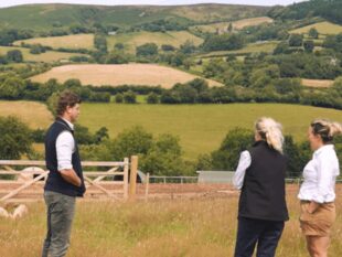
I'm very happy to see the farm become more wooded, to become more wetter, to become much more diverse, that I can stand on this hilltop in 20 years time, point to an Otter or a Kingfisher, ideally still to nesting Lapwing here.
As an example of some of the work we've been doing on the farm, we dig 1 or 2 ponds, or possibly even 3 typically in a year, and we do that to diversify the wetland habitat and create less hard edges to our ditch system across the farm. So instead of having hard-edged habitats that are very narrow we allow them to spread out with gentle edges, with much more subtle complexity to them, and then we allow the features to join up.
So this pond has joined to that pond, to this pond, and gradually we're putting these features back into a landscape and enriching that landscape by allowing all these different features to knit together and to be expanded and made more of.
This is an example of work that we've been doing really for the last 25 years across the farm to recreate the wildlife habitat special to this site.
The value of a land management plan is, it is brief, clear, concise and it needs to have outcome focus. The paperwork and the nature of the agreement needs to have that focus. You need to map what you're going to do in some way, you need to enumerate acreages of certain types of habitats that you wish to achieve, and the distance you go from your economic ordinary business of livestock keeping.
I have a long-standing belief that if it takes more than one side of paper to describe an idea then the idea isn't going to work. On this one side of A4, we had a very generalised set of prescriptions, which were about reducing our management input into each acre, and delivering the wider concept of this very specific wetland that we live in.
None of us think we're going to get it right first up and we have a continuing evolution of both knowledge and data and approaches and capability. If this piece of paper can deliver that focus that is about the farmer’s flexibility and freedom to deliver it, then I think the land management planning does what it needs to do.
So I think one of the points we made in the Test & Trial was that if we deliver conservation outputs using top-down prescriptions, you end up with hard lines and very specific colours and boundaries that don't always reflect what happens on the ground, and within this prescriptive element, let's say, 150-acre block up here, it's just one prescription across that fits those fields, when in fact those fields have a very great diversity within them and maybe they have biological interests that are not reflected in the overriding prescriptions.
So the point I've made by this being our start point in terms of conservation aspiration is that it's a very black and white issue that doesn't reflect biological variety. So I've tried to replace it with gentle pastel shades that merge through gentle ecological gradients, so it's a heat map-cum-habitat map, in which there's a much more realistic biological reflection of what's actually there. So you can see, for instance, this hard red becomes a mixture of red and blue, and it's softer, I've tried to use pastel colours because the hardness of the prescription is very limited, this becomes a very limiting factor on a site-by-site basis, and may even be anti-ecological if you're trying to impose prescriptions, rather than foster from the bottom-up environmental biological outcomes which that landscape can do. And to some extent this pattern, this sort of heat map pattern, habitat pattern, because we've been doing it for 30 years, it does sort of impose itself almost irrespective of what you do.
In this, what I've tried to do is sort of massage colours and heat-related intensities into map form, which maps also do very well, but it does obviously, it breaks down into hard data maps and field sizes and acreages, and areas and locations. So this was very much part of the Test & Trial process, how do we map your aspiration for this land?
We drove along the riverbank here and then we came into this slightly drier grassland, so it's pinkish but purpley because it's drier. The grey is traditional farmland, but you can see the green here is woodlands that we want to create, we want to put this pattern of woodland in there, which you can see will sort of slightly connect up, and the same with acknowledging the woodland on the marshland itself, this is a much wilder patch of farm but it has herb-rich meadows, so light green not productive green, and then so you begin to understand the pastel colours relate to the intensity of both, whether it's really wet or not, or whether it's really species rich or not.


 The
The 