https://defrafarming.blog.gov.uk/complete-a-runoff-and-soil-erosion-risk-assessment/
Related content and links
Our monthly newsletter
Each month, we bring together the latest policy updates, funding opportunities, consultations, research and statistics, helping you stay informed about the issues that matter to you.
Public appointment opportunity

An independent co-chair is sought for the Farm Tenancy Forum, which advises Defra on agricultural tenancy matters.
Preparing your business for the UK-EU SPS agreement

Read the new guidance to understand what the changes could mean for your business and how to prepare.
Agricultural property relief
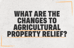
From 6 April 2026, qualifying agricultural and business assets will continue to receive full inheritance tax relief up to a combined value of £2.5 million. Lower relief rates will apply to assets above this amount. Learn more
Talk to us

28 July NSA Sheep Event at the Three Counties Showground, Malvern, Worcestershire.
30 July Launceston Show at Kennards House, Launceston, Cornwall.
Get advice
The Farming Advice Service (FAS) provides free, confidential advice to farmers and advisers.
Catchment Sensitive Farming (CSF) helps farmers in England protect water, air and soil. CSF advisers can provide advice on best practices and specific actions that will benefit your farm business and the environment.
We’ve compiled a list of organisations offering wellbeing support to those in the farming community.
Join a webinar

Livestock disease guidance

Nutrient Management Planning Tool
Are you a net zero supplier?

Innovate UK Business Connect invites you to join its new directory and connect with public sector buyers.